You are using an out of date browser. It may not display this or other websites correctly.
You should upgrade or use an alternative browser.
You should upgrade or use an alternative browser.
Flooding in Stockport
- Thread starter manimanc
- Start date
Alan Harper's Tash
Well-Known Member
- Joined
- 12 Dec 2010
- Messages
- 69,911
Distinct lack of “it’s winter” posts in here.
Flooding is about as miserable as it gets for the affected people. Hope they’re all insured and that they get sorted out quickly.
Shite way to start a year.
Flooding is about as miserable as it gets for the affected people. Hope they’re all insured and that they get sorted out quickly.
Shite way to start a year.
Really_here
Well-Known Member
And that's after they fixed it! To start with it was like a lake.I use the M60 daily and when it rains it's a death trap, it just holds the water and is lethal in parts.
bluemanchester
Well-Known Member
I was told by a retired surveyor, who lives local, that there will always be trouble on that road because it is way below the water level. That was told to me when they were having trouble when building it. Also, the Bramhall roundabout problem never happened like it does now. This is probably caused by the run off from the bypass near Poynton where the holding tanks overflow into the river that flows through Happ Valley to Bramhall park.The airport relief roads floods all the time. Seems like drainage wasn’t thought about and it’s actually causing other areas to flood.
Don't shoot the messenger;-)
Last edited:
Cheadle_hulmeBlue
Well-Known Member
- Joined
- 27 Oct 2012
- Messages
- 19,299
Sounds about right. Pushing the issue down stream. I don’t remember Bramhall having these flooding issues previouslyI was told by a retired surveyor, who lives local, that there will always be trouble on that road because it is way below the water level. That was told to me when they were having trouble when building it. Also, the Bramhall roundabout problem never happened like it does now. This is probably caused by the run off from the bypass near Poynton where the holding tanks overflow into the river that flows through Happ Valley to Bramhall park.
Don't shoot the messenger;-)
Alan Harper's Tash
Well-Known Member
- Joined
- 12 Dec 2010
- Messages
- 69,911
dobingsdobber
Well-Known Member
- Joined
- 19 Oct 2010
- Messages
- 3,432
East Didsbury looks like the seaside today.Parrs Wood fields under at least six feet of water,houses opposite on Manchester Road flooded,Waterside Hotel evacuated during the night and cars in their car park literally floating
Fletcher Moss looking bad,no road access to Cheadle from Parrs Wood.Apart from that,Happy New Year everyone!!!
Fletcher Moss looking bad,no road access to Cheadle from Parrs Wood.Apart from that,Happy New Year everyone!!!
Alan Harper's Tash
Well-Known Member
- Joined
- 12 Dec 2010
- Messages
- 69,911
I was told by a retired surveyor, who lives local, that there will always be trouble on that road because it is way below the water level. That was told to me when they were having trouble when building it. Also, the Bramhall roundabout problem never happened like it does now. This is probably caused by the run off from the bypass near Poynton where the holding tanks overflow into the river that flows through Happ Valley to Bramhall park.
Don't shoot the messenger;-)

Mike Brock
Well-Known Member
- Joined
- 22 Nov 2017
- Messages
- 1,001
Its been crazy at work today with the number of rescues of people from their homes or cars stuck in water
threespires
Well-Known Member
- Joined
- 7 Aug 2019
- Messages
- 8,644
- Team supported
- City
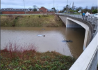
A555 near Lakeland (I think), often floods, never seen it anything like this bad though
View attachment 141823
Surreal, took me a few seconds to register where I was looking at. Horrible for everyone caught up in it all, best wishes to all impacted that the clear up can be done quickly and the insurance companies are not allowed to behave like scumbags.
west didsblue
Well-Known Member
- Joined
- 2 Oct 2011
- Messages
- 33,944
BlueMoonday
Well-Known Member
- Joined
- 26 Jul 2021
- Messages
- 4,033
- Team supported
- Manchester City Football Club
Fletcher Moss has always flooded over the years, a lot of the fields are flood plains. I imagine Toc H is flooded as well.East Didsbury looks like the seaside today.Parrs Wood fields under at least six feet of water,houses opposite on Manchester Road flooded,Waterside Hotel evacuated during the night and cars in their car park literally floating
Fletcher Moss looking bad,no road access to Cheadle from Parrs Wood.Apart from that,Happy New Year everyone!!!
bluethrunthru
Well-Known Member
I spent 40 years dealing with flood claims. Hated them. Total devastation for the customers lives and futures - you can't put a time on anything. Drying out a house takes as long as it takes, depends on type of construction - how long the water was in the property even the ongoing conditions - if there is a lot of low pressure it can take longer.
Then there is the reinstatement works. Extensive, expensive and there is a finite number of builders in any given impacted area which inevitably impacts on how long it all takes.
A rotten start to 2025 for those poor folk affected.
Then there is the reinstatement works. Extensive, expensive and there is a finite number of builders in any given impacted area which inevitably impacts on how long it all takes.
A rotten start to 2025 for those poor folk affected.
Marklr
Well-Known Member
It must flood about 5 times a year around there.
Churchlawtonblue
Well-Known Member
- Joined
- 17 May 2009
- Messages
- 16,617
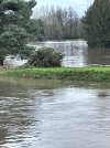
I worked on the Mersey flood defences in the 90s, but as a contractor not a designer I should add ! That area is actually designed to flood, it's a flood water compensation/ storage area. It's supposed to take up flood water and alleviate flooding in other areas. But there is clearly too much water for the design at present.Northenden golf club from the other side of the Mersey. The water in the foreground is the Mersey and it’s the golf course behind the river bank in the middle of the picture.
View attachment 141837
Millwallawayveteran1988
Well-Known Member
- Joined
- 23 Sep 2010
- Messages
- 42,112
bluethrunthru
Well-Known Member
FUCK ME !!!!
GOULDYBOBS
Well-Known Member
west didsblue
Well-Known Member
- Joined
- 2 Oct 2011
- Messages
- 33,944
The river reached its highest measured level today. Previous record was 3.22m a couple of years ago when it made the national news. Above 3.5m it’s designed to flood the golf course and Merseybank playing fields. It reached 3.76m which is unprecedented. Normal height is about 0.5m and the typical maximum is 1.8m.I worked on the Mersey flood defences in the 90s, but as a contractor not a designer I should add ! That area is actually designed to flood, it's a flood water compensation/ storage area. It's supposed to take up flood water and alleviate flooding in other areas. But there is clearly too much water for the design at present.
https://check-for-flooding.service.gov.uk/station/5101
Says at the bottom of that link, ‘Flooding might not happen again at the same historical levels. This may be because flood management schemes are now in place’.The river reached its highest measured level today. Previous record was 3.22m a couple of years ago when it made the national news. Above 3.5m it’s designed to flood the golf course and Merseybank playing fields. It reached 3.76m which is unprecedented. Normal height is about 0.5m and the typical maximum is 1.8m.
https://check-for-flooding.service.gov.uk/station/5101


