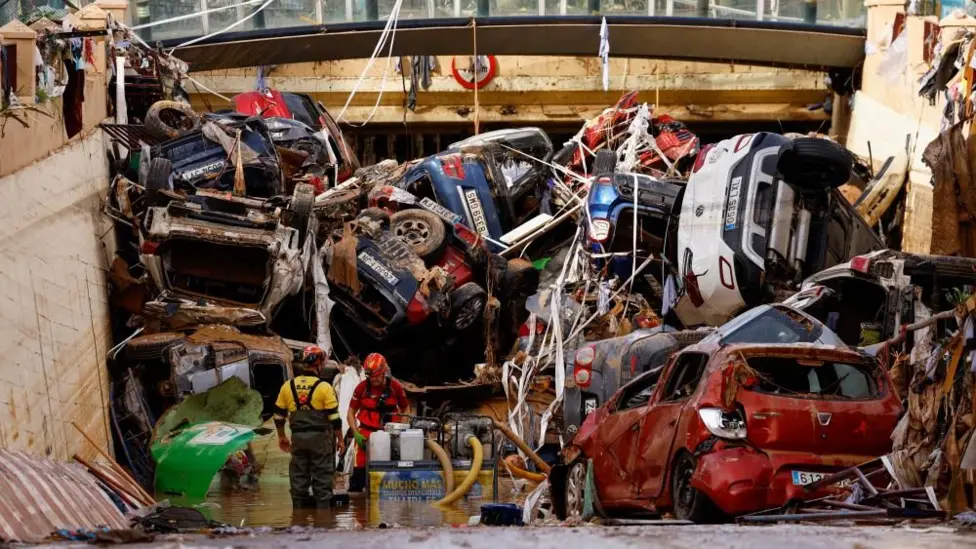
Its impossible to imagine what they'll find in this underpass.
If you look carefully on the left hand side you can see the high water marks (at an angle, parallel to the water they're pumping out).
The terrain inland from Valencia is primarily responsible for this tragedy, as the river catchment extends 100's of miles inland (see map at bottom).

Chiva (highlighted left) was the place that had a years worth of rain in a few hours.
The picture of the cars above is at Alfafar just to the right of Paiporta. I think this is that underpass.

For context of the region, both towns highlighted....

All that to the left of Chiva is effectively arable land within the catchment area (valley complex), with numerous rivers running into the one close to Valencia.
Ironically the next town to the left of Paiporta is called "Torrent".
(Maps courtesy of google earth.)

 Chiva (highlighted left) was the place that had a years worth of rain in a few hours.

