casualdeyna
Well-Known Member
I went for a stroll round West Gorton last Saturday with my girlfriend and dad as using old-maps.co.uk I was able to obtain maps of the whole area and all of City’s grounds and cross reference them to the modern day, a similar excursion to what Gary James has done with some of the academy lads. Thought I’d share my experience in case anyone else is interested or has thought of doing this.
Apologies if I’ve posted this article in the wrong place.
First thing I’d warn of is how much has changed since City moved to Maine Rd, most of it now is unrecognisable from when we played in West Gorton, most of the roads, houses and buildings don’t exist anymore, but using a bit of imagination it is still worth a trip. I’ve also got to thank the information on this site provided by Gary James, without it I would have been totally guessing at some of the locations, he certainly knows his stuff.
We started on Vaughan Street, which becomes Bennett Street as the road turns to the right, on the left hand side is the Fujitsu car park which Gary states to be the first pitch St Marks played on. On the old maps it is impossible to pinpoint the exact location as it was the Union Iron Works, there is a few spaces there dotted between buildings so it could really have been any of them.
On the opposite side of Bennett St there seems to be a building that still exists from the St Marks days as it definitely appears older than the surrounding buildings has a fairly grand entrance, certainly compared to everything else in the area. On the old maps it is either Brook Forge or a nameless building next to it.
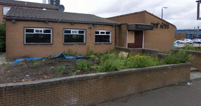
Bennett St is one of the few roads that hasn’t been diverted over the years, it follows the same layout in the old maps as it does today, so as you stroll down it you will be tracing the same footsteps as thousands of City fans going to Hyde Road, even if it looks very different today. Another building further down Bennett St that hasn’t changed is St Benedict’s Church, it is a pretty imposing structure, certainly compared to the picture I have seen of St Marks. Today it is the Manchester Climbing Centre which gives you an idea of the size of the building.
Carrying on down Bennett St on the right hand side is a fairly new estate, this was the site of the Galloway Boiler Works, that gave its name to one of Hyde Road’s stands. It’s hard to imagine now but it was a substantial complex when City used to play next door.
Carrying on, as the road bends slightly to the left you will see the shipping container depot on your right, this was Hyde Road, and as it is mostly empty space it is easier to imagine the ground then pretty much all of the other places of interest. Someone may correct me here but on all the old maps I have found I can only find one entrance in to the ground and that was on Bennett St opposite Rostron Street, which is now Rostron Avenue. As Hyde Road was surrounded on all sides it is likely Bennett St was the only way in, I just can’t believe they funnelled 30,000 – 40,000 fans in and out of just one entrance in the later days before the relocation. There were also houses on Bennett Street here so there could only have been a handful of entrances at most. Even if there was more than one way in I can imagine huge queues trying to get in the ground before kick-off stretching down Bennett St and probably on to Hyde Road itself, especially for big games.
Even if nothing of the ground exists I probably enjoyed this part of the walk the most, imagining literally thousands of blues packed around strolling to the ground and queuing for what must have been a fair time to get in the ground, then the excitement once they were finally in. This is helped by crossing under the railway bridge which appears to date back to when Blues would have walked or queued underneath it on the way to the ground. You can compare this bridge to the “Fenian Arch” just round the corner on Hyde Road itself which has clearly been replaced relatively recently. (If you haven’t heard of the “Fenian Arch” have a read of the Manchester Martyrs on Wikipedia, worth a read and within spitting distance of the Hyde Road ground.)
We carried on to Hyde Road and even though it is close to the ground it makes you wonder why it was called Hyde Road ground and not Bennett Street (my granddad used to refer to it as the Bennett St ground), it would have been like calling Maine Road, Claremont Road. Just under the bridge there used to be a Smithy, and an alleyway that led to the back of the Hyde Road hotel. Presumably this is the alley that the players used to go down to the ground in the early days, after getting changed in the Hyde Rd Hotel. Nothing exists of the alley or the Hyde Rd hotel, but it will be much easier to imagine for those who remember it when it was the City Gates.
We then went to Clowes Street where City were born. This has changed pretty much beyond all recognition. Clowes St was a myriad of two-up two-down houses with an almost endless amount of adjoining roads and it is clear from the old maps what a densely populated area it must have been. There was also a tramline that went the length of Clowes St. Today, about a third of the way down the road has been re-routed and bends round to the right, when originally it was a straight road. You can walk down Gorton Villa Walk which follows the old route of Clowes St towards where St Marks was situated. Before you enter Gorton Villa Walk it is a worth a quick look to your right at Ainsdale Street which appears to have survived so gives a good impression of what the whole area would have looked like.
About half way down Gorton Villa walk is a row of shops, on the video of Gary James on mcfc.co.uk he states St Marks was close to here, using the old maps and cross referencing (I used Bennett Street as it is unaltered and tried to plot it from there) I worked out it may be just past these shops where there is a row of housing, but it’s splitting hairs as it is there or thereabouts. As it has changed so much you can’t really imagine any of the church, but at least I can say now that I’ve been to where St Marks used to be.
The rest of the walk is away from West Gorton. We skipped out Queens Road which is now Gorton Park (it is another place that you can’t pinpoint exactly on the old maps, so it may have been just to the right of the modern Gorton Park or slap bang in the middle of it) and Bull’s Head near Reddish as it was a bit out of our way home and it was a long walk (We started in town). Nothing exists of Kirkmanshulme Cricket club now but according to the old maps the equivalent modern location is Norman Grove. Pink Bank Lane is just around the corner but this is another place that can’t be pinpointed as it is mostly fields in the late 1800’s.
So even though there isn’t much “in situ” as Time Team would say I would recommend you take a look if you have a spare couple of hours, just to see the area of our birth and tread in the same footsteps as Blues of past generations. The one thing it makes you appreciate is that, Bulls head aside, how all the different locations are all within walking distance so you can appreciate the fuss that was made when they moved to Maine Rd. City were a traditionally a West Gorton club so Moss Side must have seemed a million miles away even if you could jump on a tram to the new ground.
Apologies if I’ve waffled on a bit but thought it best to give too much information rather than too little as using this info you should be able to “walk” all of it on Google Street view, apart from Gorton Villa Walk, in case you would prefer to do the walk from your own home, or when you really should be working!
Apologies if I’ve posted this article in the wrong place.
First thing I’d warn of is how much has changed since City moved to Maine Rd, most of it now is unrecognisable from when we played in West Gorton, most of the roads, houses and buildings don’t exist anymore, but using a bit of imagination it is still worth a trip. I’ve also got to thank the information on this site provided by Gary James, without it I would have been totally guessing at some of the locations, he certainly knows his stuff.
We started on Vaughan Street, which becomes Bennett Street as the road turns to the right, on the left hand side is the Fujitsu car park which Gary states to be the first pitch St Marks played on. On the old maps it is impossible to pinpoint the exact location as it was the Union Iron Works, there is a few spaces there dotted between buildings so it could really have been any of them.
On the opposite side of Bennett St there seems to be a building that still exists from the St Marks days as it definitely appears older than the surrounding buildings has a fairly grand entrance, certainly compared to everything else in the area. On the old maps it is either Brook Forge or a nameless building next to it.
Bennett St is one of the few roads that hasn’t been diverted over the years, it follows the same layout in the old maps as it does today, so as you stroll down it you will be tracing the same footsteps as thousands of City fans going to Hyde Road, even if it looks very different today. Another building further down Bennett St that hasn’t changed is St Benedict’s Church, it is a pretty imposing structure, certainly compared to the picture I have seen of St Marks. Today it is the Manchester Climbing Centre which gives you an idea of the size of the building.
Carrying on down Bennett St on the right hand side is a fairly new estate, this was the site of the Galloway Boiler Works, that gave its name to one of Hyde Road’s stands. It’s hard to imagine now but it was a substantial complex when City used to play next door.
Carrying on, as the road bends slightly to the left you will see the shipping container depot on your right, this was Hyde Road, and as it is mostly empty space it is easier to imagine the ground then pretty much all of the other places of interest. Someone may correct me here but on all the old maps I have found I can only find one entrance in to the ground and that was on Bennett St opposite Rostron Street, which is now Rostron Avenue. As Hyde Road was surrounded on all sides it is likely Bennett St was the only way in, I just can’t believe they funnelled 30,000 – 40,000 fans in and out of just one entrance in the later days before the relocation. There were also houses on Bennett Street here so there could only have been a handful of entrances at most. Even if there was more than one way in I can imagine huge queues trying to get in the ground before kick-off stretching down Bennett St and probably on to Hyde Road itself, especially for big games.
Even if nothing of the ground exists I probably enjoyed this part of the walk the most, imagining literally thousands of blues packed around strolling to the ground and queuing for what must have been a fair time to get in the ground, then the excitement once they were finally in. This is helped by crossing under the railway bridge which appears to date back to when Blues would have walked or queued underneath it on the way to the ground. You can compare this bridge to the “Fenian Arch” just round the corner on Hyde Road itself which has clearly been replaced relatively recently. (If you haven’t heard of the “Fenian Arch” have a read of the Manchester Martyrs on Wikipedia, worth a read and within spitting distance of the Hyde Road ground.)
We carried on to Hyde Road and even though it is close to the ground it makes you wonder why it was called Hyde Road ground and not Bennett Street (my granddad used to refer to it as the Bennett St ground), it would have been like calling Maine Road, Claremont Road. Just under the bridge there used to be a Smithy, and an alleyway that led to the back of the Hyde Road hotel. Presumably this is the alley that the players used to go down to the ground in the early days, after getting changed in the Hyde Rd Hotel. Nothing exists of the alley or the Hyde Rd hotel, but it will be much easier to imagine for those who remember it when it was the City Gates.
We then went to Clowes Street where City were born. This has changed pretty much beyond all recognition. Clowes St was a myriad of two-up two-down houses with an almost endless amount of adjoining roads and it is clear from the old maps what a densely populated area it must have been. There was also a tramline that went the length of Clowes St. Today, about a third of the way down the road has been re-routed and bends round to the right, when originally it was a straight road. You can walk down Gorton Villa Walk which follows the old route of Clowes St towards where St Marks was situated. Before you enter Gorton Villa Walk it is a worth a quick look to your right at Ainsdale Street which appears to have survived so gives a good impression of what the whole area would have looked like.
About half way down Gorton Villa walk is a row of shops, on the video of Gary James on mcfc.co.uk he states St Marks was close to here, using the old maps and cross referencing (I used Bennett Street as it is unaltered and tried to plot it from there) I worked out it may be just past these shops where there is a row of housing, but it’s splitting hairs as it is there or thereabouts. As it has changed so much you can’t really imagine any of the church, but at least I can say now that I’ve been to where St Marks used to be.
The rest of the walk is away from West Gorton. We skipped out Queens Road which is now Gorton Park (it is another place that you can’t pinpoint exactly on the old maps, so it may have been just to the right of the modern Gorton Park or slap bang in the middle of it) and Bull’s Head near Reddish as it was a bit out of our way home and it was a long walk (We started in town). Nothing exists of Kirkmanshulme Cricket club now but according to the old maps the equivalent modern location is Norman Grove. Pink Bank Lane is just around the corner but this is another place that can’t be pinpointed as it is mostly fields in the late 1800’s.
So even though there isn’t much “in situ” as Time Team would say I would recommend you take a look if you have a spare couple of hours, just to see the area of our birth and tread in the same footsteps as Blues of past generations. The one thing it makes you appreciate is that, Bulls head aside, how all the different locations are all within walking distance so you can appreciate the fuss that was made when they moved to Maine Rd. City were a traditionally a West Gorton club so Moss Side must have seemed a million miles away even if you could jump on a tram to the new ground.
Apologies if I’ve waffled on a bit but thought it best to give too much information rather than too little as using this info you should be able to “walk” all of it on Google Street view, apart from Gorton Villa Walk, in case you would prefer to do the walk from your own home, or when you really should be working!