Is this a new plan or a previous one?
I believe this is the Grey Mare Lane Regeneration Masterplan published on 2 November 2023, which downloaded as a 94-page PDF for me when I clicked here. The Council's consultation on the above document was due to complete on 22 July 2024. Not sure yet what the outcome is.
I discovered this only last night so I still haven't had chance to read it through yet and am a bit busy at the moment. I'll report back on anything that seems relevant for MCFC given that our stadium is immediately to the north of this area and the our training ground is on the other side of Alan Turing Way to the east.
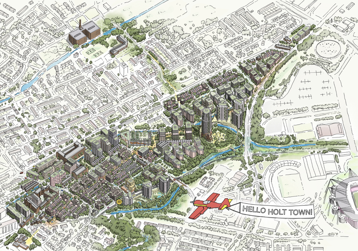
Meanwhile, a couple of questions I've had for the last week or two about the proposed Holt Town regeneration announced recently and sketched out in the image featured in the post I quote below:
First, the National Grid announced back in March that it was putting up for sale three sites around the Etihad Campus as follows:
Two of the plots are former gasholder sites, with the largest spanning 10 acres. The gasholder has been removed and the site has been levelled.
The second largest site is a little over five acres and also features a former gasholder, which is in the process of being removed.
The third site is a one-acre landlocked L-shaped plot close to the Blue car park at the Etihad.
Am I right that the first and third of those plots are covered by the Holt Town regeneration area as shown on the map, while the second, the gasholder qat the top of the North Car Park, is outside that zone?
And second, am I right that the area between Ashton New Road and the Ashton Canal is land, including the former Edwin Road Industrial Estate, that was compulsorily purchased by MCC and was intended to house the proposed Sport and Innovation Zone intended to be operatued in partnership with Manchester Metropolitan University?
It's been a long time since those plans fell through but it would be nice to think that in due course, they could maybe find a suitable partner and bring forward new plans along similar lines.

